
HIKING FROM MUNICH · TEGERNSEE
Neureuth Hike from Munich: Which Trail Should You Take?
Two ways up the mountain, a lunch stop at Berggasthof Neureuth, and a different experience on the way down.
From Tegernsee station, there are two main ways to reach Berggasthof Neureuth. On the counterclockwise loop, you climb a mountain road around 3–5 metres wide to Berggasthof Neureuth, then descend on a narrow forest trail, mostly 1–2 metres wide, with exposed roots. Going clockwise reverses that order. The choice matters, especially if steep descents are hard on your knees.
01Three hikes on the same mountain
I made the Neureuth hike from Munich three times between September and early October 2026. I first went with family and later returned with friends. It makes a practical day trip from Munich: you can arrive by train, hike up, and have lunch at the mountain restaurant.
But the three walks felt surprisingly different. Twice I followed the counterclockwise loop. Once I went up the narrow forest trail and returned the same way. I had also walked the clockwise loop in 2023.
What changed most was the climb and descent, not the distance.
02Taking the BRB train from Munich to Tegernsee
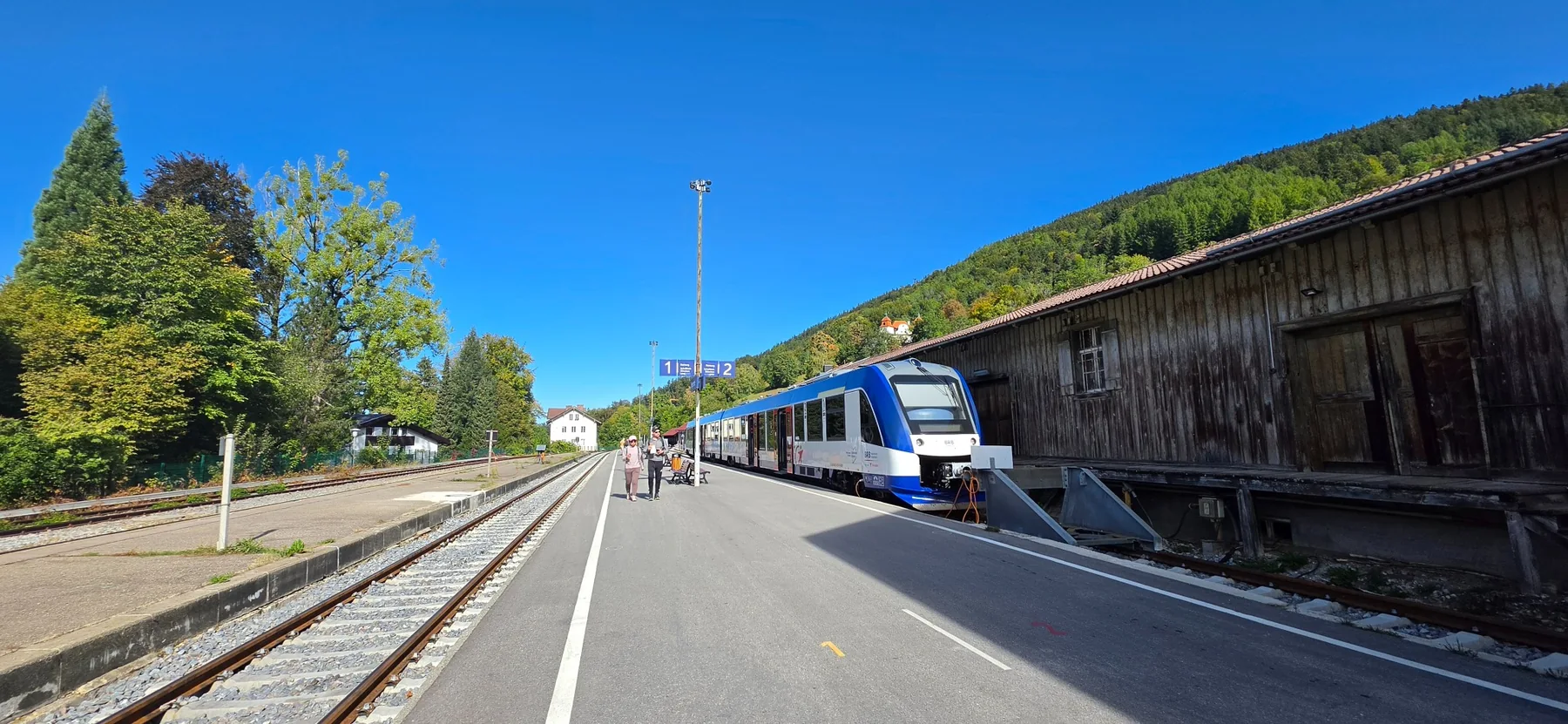
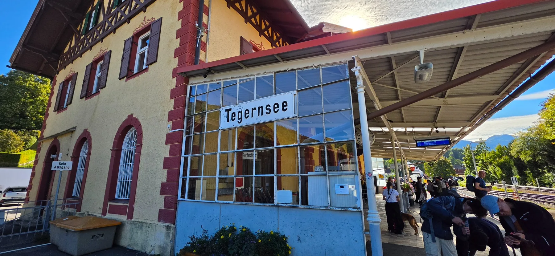
From München Hauptbahnhof, the BRB regional train runs directly to Tegernsee. My journeys took about 70–75 minutes. The train can divide into sections for different destinations, so check that you are sitting in a carriage marked Tegernsee.
On weekend mornings, the train may already be waiting at the platform well before departure. Arriving 15–20 minutes early gives you a better chance of finding a seat. I preferred the right side going towards Tegernsee and the left side when leaving Tegernsee. The return train changes direction at Schaftlach, so the same seat then becomes the right side. On my trips this reduced direct sun for part of the journey, although it depends on the time of day and season.
On 26 September, our planned morning train was cancelled and the platform changed. Check DB Navigator and the station displays shortly before departure, even if you arrive early. It is worth checking the return train too.
During these dates, replacement buses (SEV) operate instead of trains between Schaftlach and Tegernsee. DB Navigator may route you from Munich on an RB56 or RB57 train, then onto a replacement bus at Schaftlach. In the journey examples I checked, the walk to the bus stop was about 5 minutes, and the total trip from Munich Hauptbahnhof to Tegernsee took around 1 hour 21–28 minutes, including the bus. Check the bus stop location and departure times before traveling using BRB service updates and DB Navigator. This is a temporary notice; other timetable changes may follow.
The Deutschlandticket is valid on this regional service. If buying separate tickets from central Munich, you need the MVV M–7 zones. In 2026, an M–7 day ticket cost 20.50 € for one adult or 36.20 € for a group of two to five people. Even for two travellers, the group ticket was cheaper than two individual day tickets. Check the fare for your travel date on the MVV website.
03Neureuth hike from Munich: clockwise or counterclockwise?
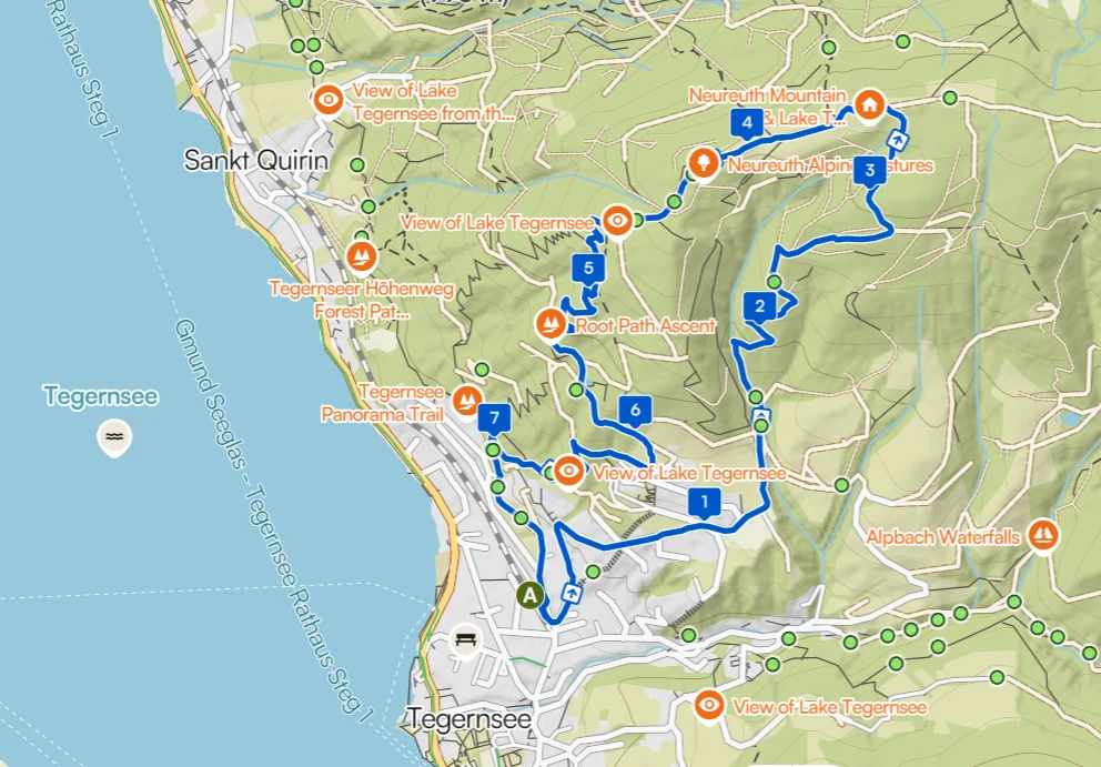
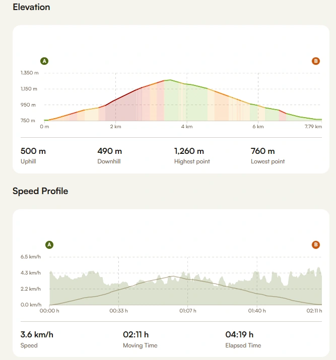
My Komoot record for 26 September shows 7.78 km, 2 hours 11 minutes of moving time, and about 500 m between the lowest point (around 760 m) and the highest (around 1,260 m). Including lunch, photos and breaks, the whole outing took 4 hours 19 minutes. Allow more time if you plan a long lunch or frequent stops.
| Feature | Counterclockwise | Clockwise |
|---|---|---|
| Path width | Ascent to hut: wide road around 3–5 m; descent: root covered trail around 1–2 m | Ascent to hut: root covered trail around 1–2 m; descent: wide road around 3–5 m |
| Surface | Wide mountain road with some sunny sections | Shaded forest path with exposed roots |
| Climb | Long, steady climb that takes effort | Winding ascent through the forest |
| Descent | Narrow forest path with roots | Wider but steeper mountain road |
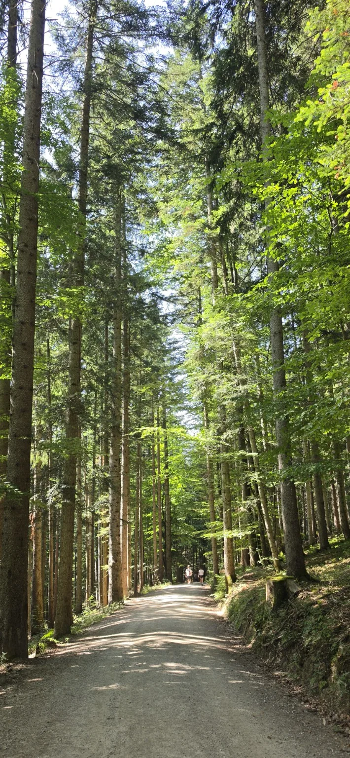
Going counterclockwise means climbing the wide road to the restaurant. It is not an easy climb, but I preferred to walk that steep section uphill rather than put the same load on my knees coming down. Clockwise takes you up the narrow forest trail and sends you back down the wider road.
On one visit I went up and down the forest trail instead of completing the loop. That avoided the steep road descent, although wet roots can also be slippery. If your knees are a concern, think about both the gradient and the surface you will descend on.
My routes on Komoot
These are two hikes I recorded on Komoot. On 26 September, I walked the counterclockwise loop. On another visit, I climbed the narrow forest trail and returned along the same path. The second route is an out and back hike, not a clockwise loop. Open either record for the route details and photos.
26 September · Counterclockwise loop
Forest trail out and back
04The wide road up to Neureuth
Parking Tegernsee Neureuth
Neureuthstraße 60, 83684 Tegernsee
See the parking location on Google Maps →
You can start from this parking area instead of walking from Tegernsee station. Spaces looked limited when I passed, so arriving early on weekends may help. Google Maps lists the parking area as open 24 hours, but a sign photographed in September 2026 said a parking ticket is required daily from 08:00 to 19:00. Open 24 hours does not mean free parking. Recent visitor photos of the machine showed the first hour free, then 2 € per hour, or 8 € for a day ticket. Check the machine when you arrive, as prices and rules may change. You still need to walk uphill to reach the restaurant.
On the counterclockwise ascent to the restaurant, the road is around 3–5 metres wide. Much of it passes through forest, with some exposed stretches in the sun. I met several people climbing on electric mountain bikes. That does not mean cycling is permitted on every path in the area.
There are few views of Lake Tegernsee on this ascent. Most of the time, you are simply working your way uphill towards the restaurant.
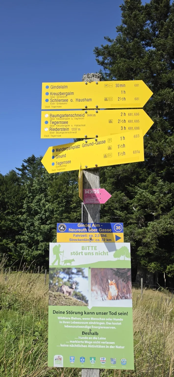
Near the top, a sign points towards Neureuth and Schliersee. You can continue on a longer hike from here. We chose lunch at Neureuth and the return route to Tegernsee.
05Lunch at Berggasthof Neureuth
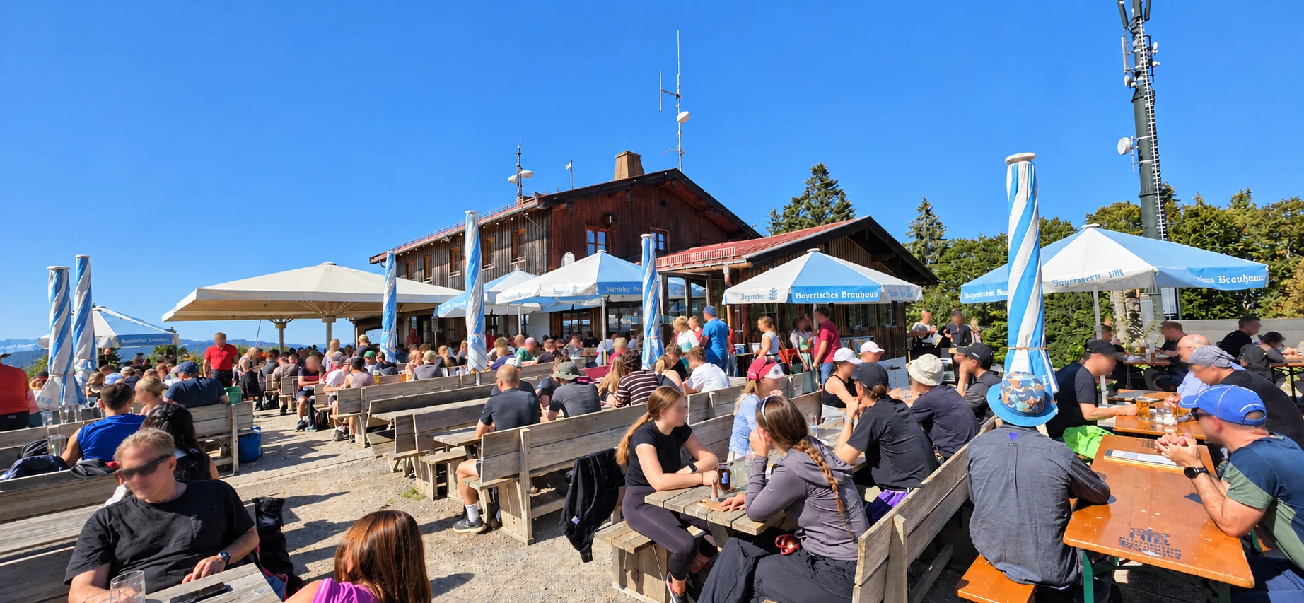
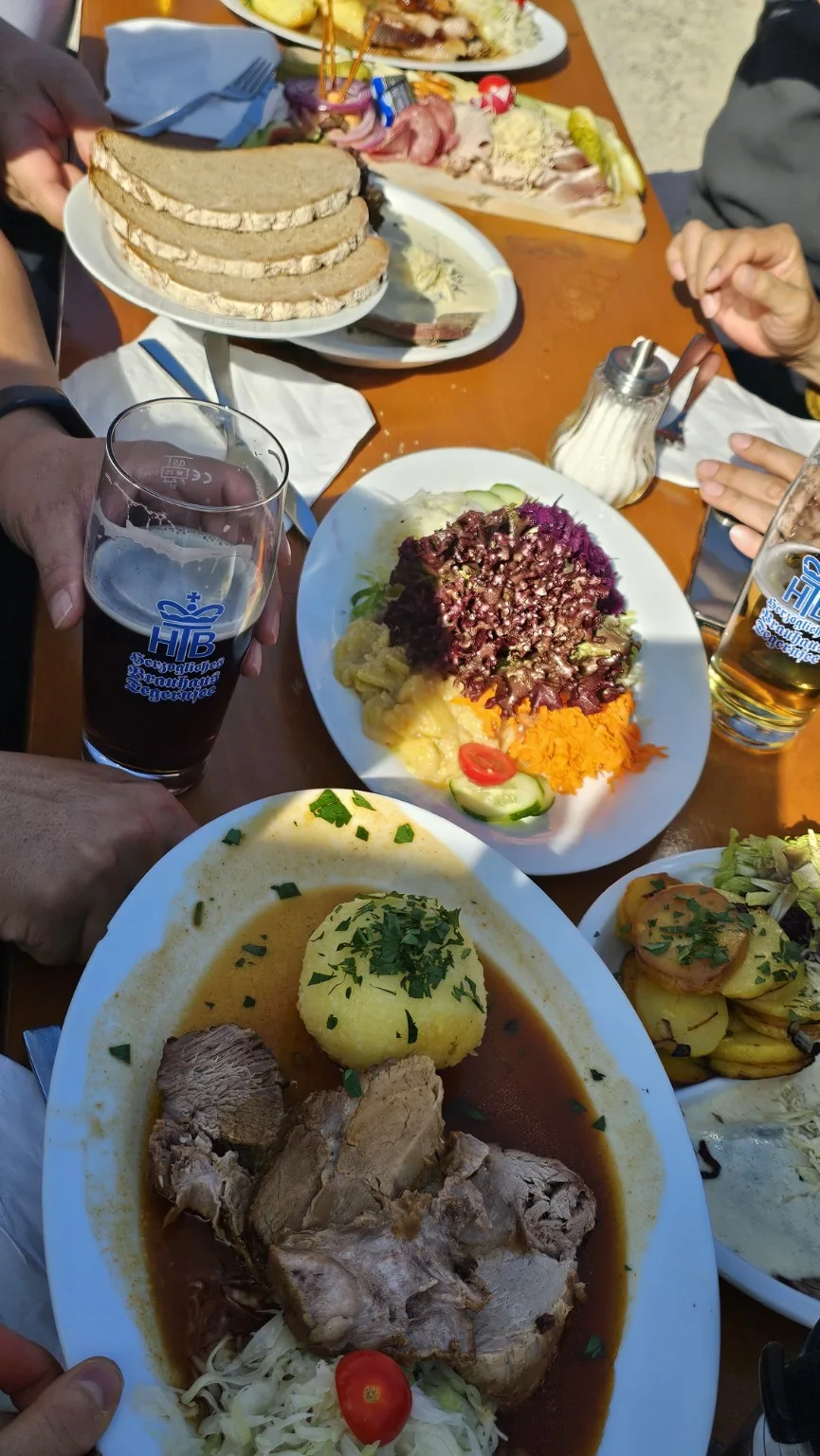
Lunch on the terrace at Berggasthof Neureuth was one of the best parts of the day. During my September 2026 visit, Tafelspitz in Meerrettichsoße cost 18.90 € and Schweinebraten cost 16.90 €. I especially liked the Tafelspitz with horseradish sauce. These were the prices during my visit, so check the menu again before ordering.
The menu said cash only. Bring enough cash for food and drinks. Opening days and kitchen hours can change with the season or special events; check the restaurant website before setting out.
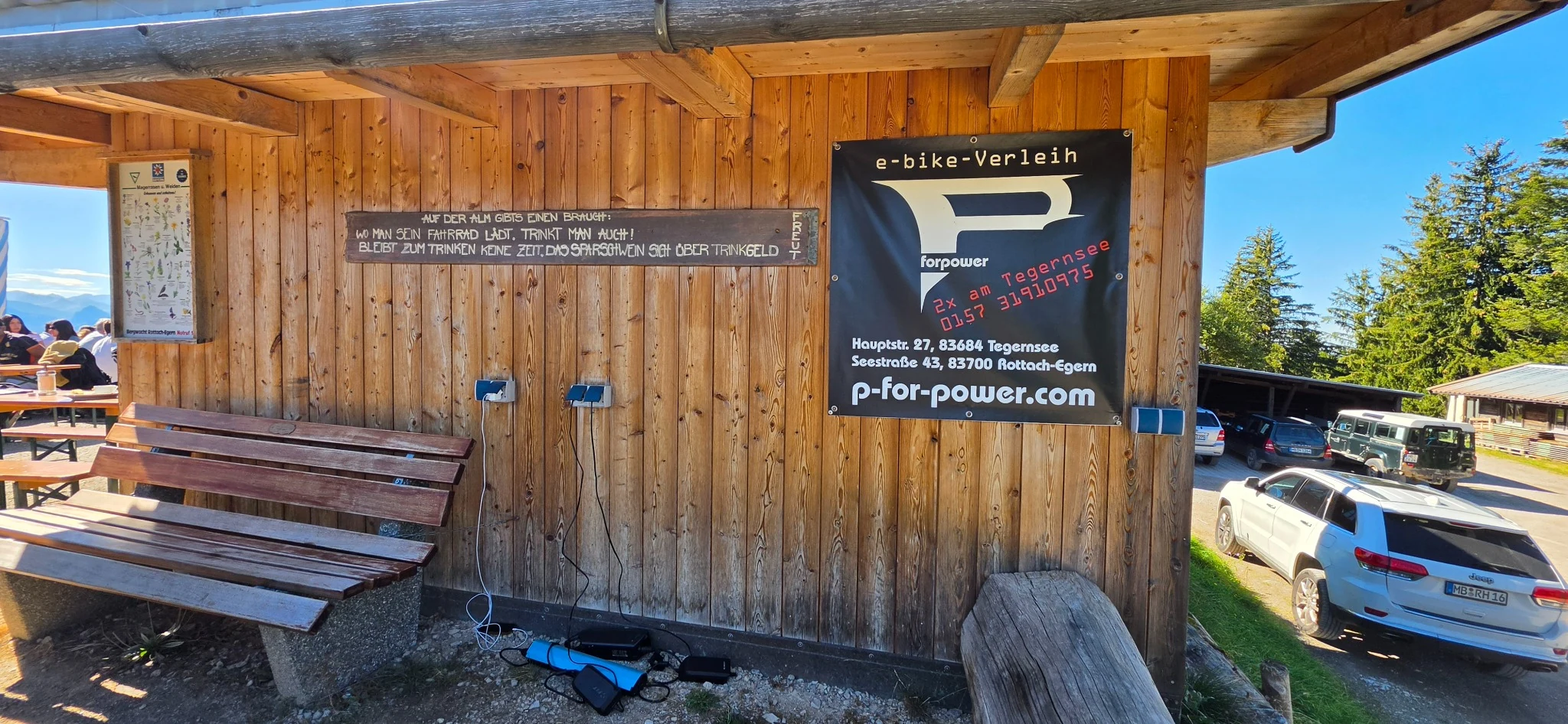
The restaurant also had sockets for charging electric bikes. A handwritten German sign on the wooden wall made me smile: if you charge your bike here, have a drink too. If you have no time for a drink, the tip jar will be happy instead. It is a friendly request, not a posted charging fee. If you plan to cycle up, check which roads permit bikes. I would not recommend the narrow, root covered forest trail as a cycling route.
06The forest descent and lake views
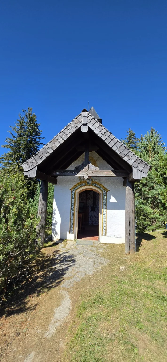
About 100 metres after leaving the restaurant, you pass a small chapel. Inside are memorial plaques for local people who did not return from the First and Second World Wars.
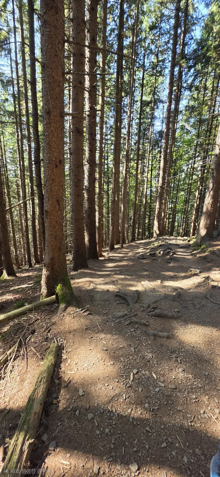
The trail then enters dense forest. It is mostly 1–2 metres wide, with many exposed roots. Watch where you place your feet, especially after rain.
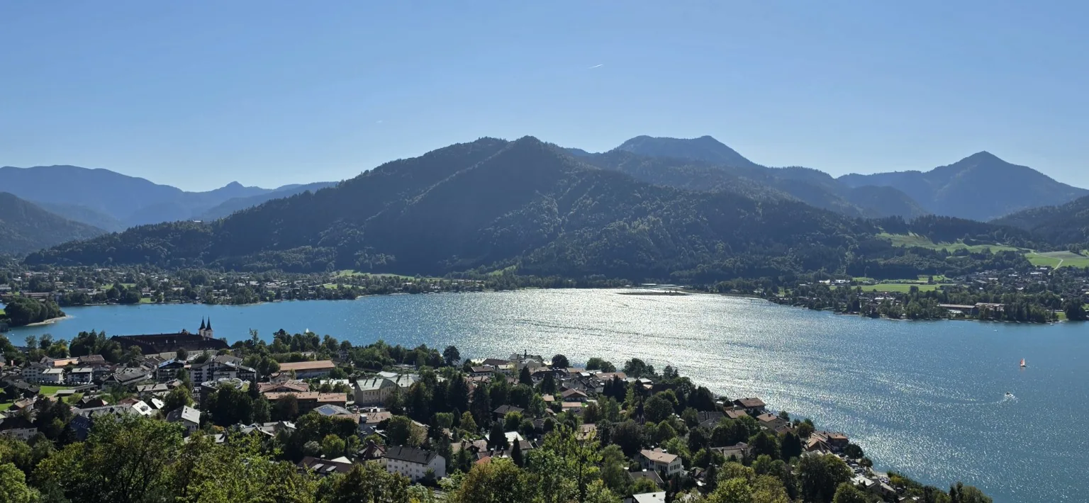
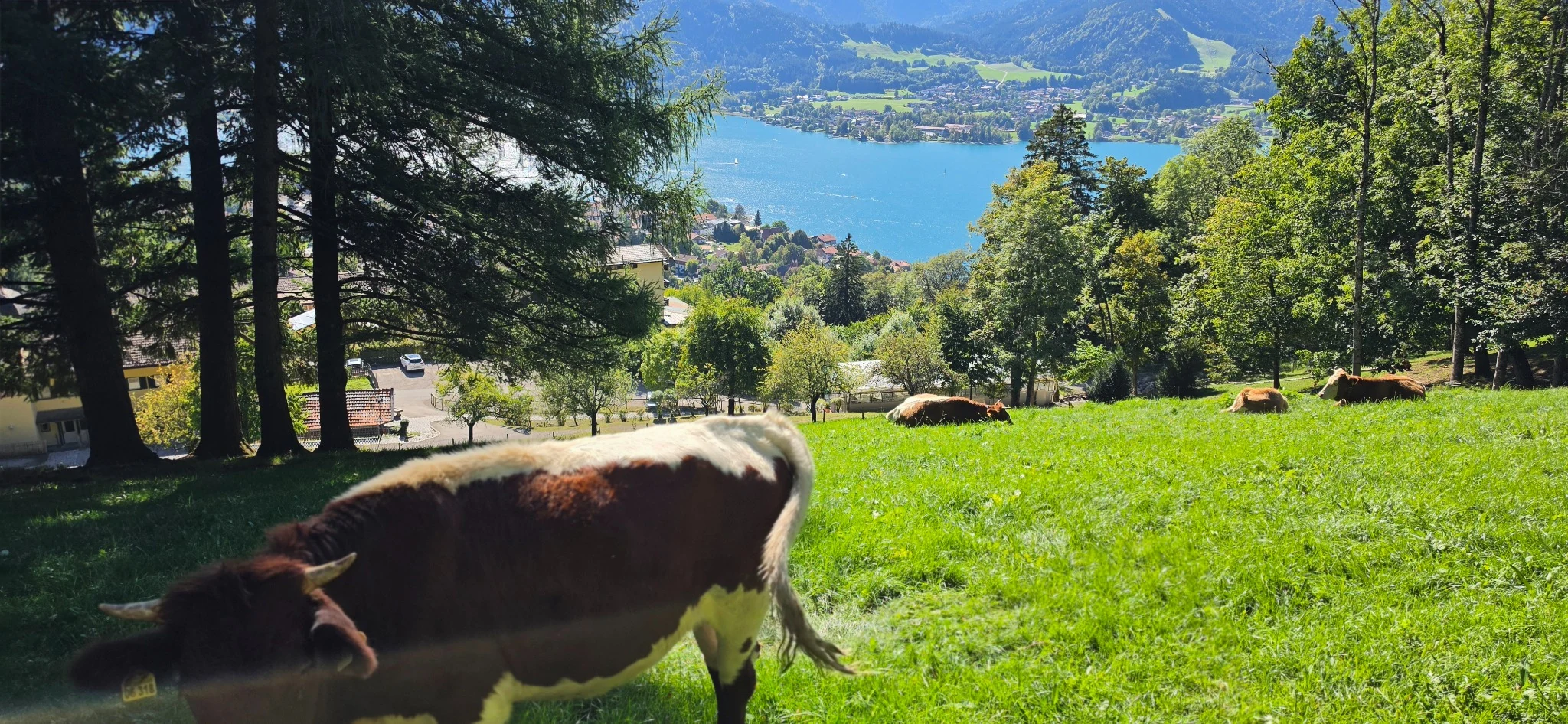
This is where I had the better lake views. Tegernsee appears between the trees, and there are places where you can stop and enjoy the open view. On the counterclockwise loop, the lake scenery comes mainly during the descent.
07Which direction would I choose?
After three recent visits and my earlier clockwise hike, I would not choose this route based on distance alone. For me, the harder decision is which trail to take downhill.
Choose the counterclockwise loop if you prefer climbing on a wide road, stopping for lunch, then descending through the forest with lake views. Choose clockwise if you enjoy climbing a narrow, shaded trail, but remember that you will descend the wider, steeper road.
If you like the forest path but want to avoid the steep road descent, returning along the same forest path is another option. In any direction, wear proper hiking shoes, bring water, and take extra care on roots and loose stones after rain.
I would happily return for the lunch and the view over Tegernsee. Next time, the weather and trail conditions will decide which way I walk.
Comments & Questions
Have a question or an experience to share? Leave a comment below.